WÄHLE DEINEN WEG
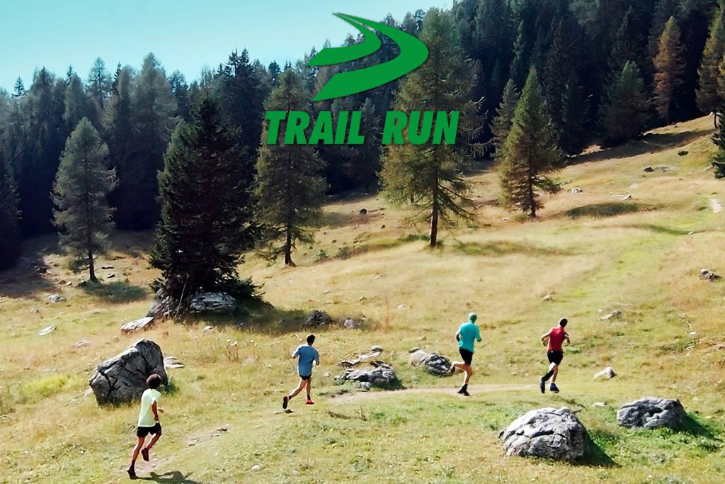
TOP DOLOMITES TRAIL RUN
Ein spektakulärer Weg mit 3 verschiedenen Wegen, umgeben von den Brenta-Dolomiten. Ein einzigartiges Abenteuer, allein oder mit Freunden beim größten Outdoor-Festival der Brenta-Dolomiten zu leben. Am 1. Juni können Sie je nach Ihren Leistungen einen der drei Wege in Angriff nehmen, bis Sie Ihren Traum vom Ultra Trail erreichen, der die Grosté-Gipfel über Madonna di Campiglio erreicht und bis zur Ankunft in Pinzolo zwischen Musik und Unterhaltung eintaucht Ihre Freunde, Familie und Enthusiasten werden auf Sie warten und Ihren Traum teilen!!!
ULTRA TRAIL
49 km – 2500 m – 7 Erfrischungspunkte
Die Ultra Trail Route ist eine Mischung aus Farben und Ausblicken, die uns nur die Brenta-Dolomiten bieten können. Der Start erfolgt im Zentrum von Pinzolo und kurz nach 500 Metern tauchen Sie in den Wald ein, wo der Hauptanstieg des Tages, der Pra Rodont, beginnt. Am Anfang ist der Weg breit, dann schrumpft er in Richtung Malga Baldaros (7 km Anstieg und 800 Höhenmeter).
Dieser spektakuläre Weg inmitten des Unterholzes der Brenta-Dolomiten ermöglicht es Ihnen, die Gruppe aufzuteilen, so dass jeder sein eigenes Tempo einschlagen kann und am Gipfel ankommt, wo Sie eine weite offene Wiese und Malga Badalors finden, wo der erste Erfrischungspunkt eingerichtet wird hoch. Die Bemühungen sind noch nicht vorbei! Wir steigen wieder leicht im Unterholz hinauf (1,5 km und 230 Meter positiver Höhenunterschied), wo wir 1830 Meter Höhenunterschied erreichen und am oberen Ende des Waldausgangs auf unserer rechten Seite die Malga Movlina finden. Von hier aus können wir das umliegende Panorama der Brenta-Dolomiten auf der einen und anderen Seite betrachten, befinden uns auf einer spektakulären Kruste und sobald wir die Madonnina hinter uns gelassen haben, beginnen wir mit dem Abstieg, der uns in das verzauberte Paradies führt, bis wir uns im Valagola-See spiegeln, in dem wir uns wiederfinden Bei km 11 und 1600 Höhenmetern erwartet Sie eine leicht bergab führende Straße.
Hier, beim Abstieg, gibt es die zweite Erfrischungsstelle und wir befinden uns direkt vor der Brenta Bassa bei Kilometer 15 und 1200 Höhenmetern, eingebettet in ein prächtiges Amphitheater aus Bäumen, das als Sprungbrett in Richtung Brenta Alta dienen wird ( 7 km und 600 Höhenmeter positiver Höhenunterschied). Nach Brenta Alta erreichen wir die Casinei-Hütte, wo wir bei km 23 die Erfrischungsstelle Nr. 3 finden. Dann geht es bergab zu den Valesinella-Wasserfällen (die wir beim Abstieg auf der rechten Seite beobachten können), bevor wir vor einem wirklich tollen Anstieg stehen , der Graffer. Bei Kilometer 24 und 1700 Metern im Gebiet Valesinella Alta nehmen wir den 4,5 Kilometer langen Weg, der uns mit einem Höhenunterschied von 2250 Metern und zurückgelegten 28,5 Kilometern zum höchsten Punkt der Route führt: dem Graffer. Hier finden wir die vierte Erfrischung des Tages und die spektakulären Brenta-Dolomiten mit Blick auf die Sonne. Sobald Graffer in Angriff genommen wurde, werden diejenigen, die sich im Abstieg auskennen, den Unterschied machen. Tatsächlich erwartet uns ein langer Singletrail-Weg, der uns nach 4 km Abstieg zunächst zur Malga Vagliana und kurz nach Vaglianella führt, bis wir in Fortini am Fuße des Grostè den vorletzten Verpflegungspunkt des Tages (Nummer 5) erreichen Sessellift (1700 Höhenmeter und 35 km bewältigt), wo eine spektakuläre Abfahrt mitten im Wald an Madonna di Campiglio entlang führt, wo wir den letzten Anstieg des Tages, den von Circina, nehmen, der uns zum letzten Erfrischungspunkt 7,5 bringt Kilometer von der Ankunft in Mavignola entfernt und auf einem breiten Weg bergauf in Richtung Piazza a Pinzolo, immer leicht bergab, wo Sie das Publikum finden, das auf Ihren Triumph wartet.
MEDIUM
22 km – 1550 m – 2 Erfrischungspunkte
Die mittlere Route beginnt im Zentrum von Pinzolo und nach etwas mehr als 500 Metern befinden wir uns im Wald, wo der erste richtige Anstieg des Tages in Richtung Pra Rodont beginnt. Bei km 7 und 800 Höhenmetern positiver Höhendifferenz erreichen wir Malga Bandalors. Dieser spektakuläre Weg inmitten des Unterholzes der Brenta-Dolomiten ermöglicht es uns, die Gruppe aufzuteilen, sodass jeder sein eigenes Tempo einschlagen kann und am Gipfel ankommt, wo sich eine weite offene Wiese und Malga Badalors befinden, wo der erste Erfrischungspunkt eingerichtet wird hoch. Die Bemühungen sind noch nicht vorbei! Wir steigen wieder leicht im Unterholz hinauf (1,5 km und 230 Meter positiver Höhenunterschied), wo wir 1830 Meter Höhenunterschied erreichen und am oberen Ende des Waldausgangs auf unserer rechten Seite die Malga Movlina finden. Von hier aus ist die große Anstrengung fast vorbei, wir können auf der einen Seite das umliegende Panorama der Brenta-Dolomiten betrachten, auf der anderen finden wir uns auf einer spektakulären Kruste wieder, und nach der Madonnina beginnen wir mit dem Abstieg, der uns in das verzauberte Paradies führt , gegenüber einer leicht bergab führenden Straße bei km 11 und 1600 Höhenmetern. Wir erreichen den Valagolasee. Hier nehmen wir den letzten Anstieg des Tages in Angriff, den Circina, der uns 7,5 km nach der Ankunft in Mavignola zum letzten Erfrischungspunkt führt und auf einem breiten Weg zur Piazza San Gicomo a Pinzolo führt, immer leicht bergab, wo Sie finden Die Öffentlichkeit wartet auf deinen Triumph.
SHORT
10 km – 690 m – 1 Erfrischungspunkt
Die kurze Route beginnt an der Piazza San Giacomo in Pinzolo und nach etwas mehr als 500 Metern befinden wir uns im Wald, wo der erste richtige Anstieg des Tages in Richtung Pra Rodont beginnt. Wir werden den Gipfel nicht erreichen, aber bei km 3,8 erreichen wir eine leichte Steigung mit einer kleinen asphaltierten Abfahrt von etwa 1,5 km. Dann erreichen wir einen spektakulären Singletrail von 0,6 km Länge, immer bergab, der uns zu den beiden anderen Routen in Mavignola bis zur Piazza San Giacomo in Pinzolo führt, immer leicht bergab, wo sich das Publikum befindet Ich warte auf deinen Triumph.